The Israel Trail
One of the Best Epic Hikes in the World
National Geographic includes the Israel Trail as one of the top twenty epic hikes in the world.
Hiking the Israel National Trail is truly unique for two main reasons. First off, because it passes through such diverse, distinct regions of natural beauty. Ranging from breathtaking desert scenery;

Green mountains and fields;

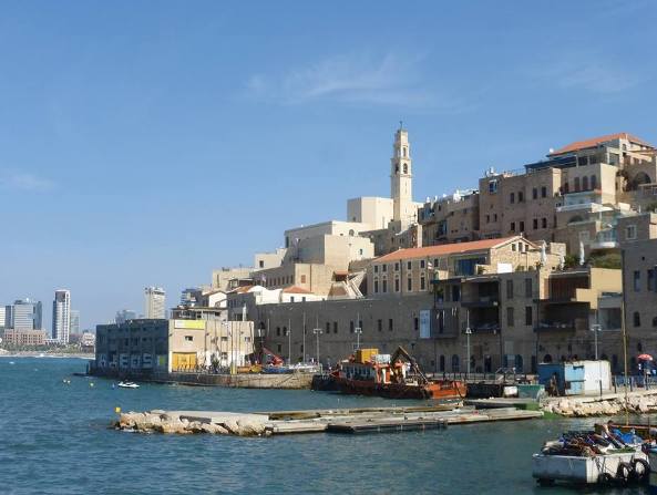
and the Mediterranean shore;

But what makes walking the trail so special is how it immerses you, beyond natural wonders, in the incredible history and culture of the land of Israel.
As you walk the trail, you will see many Biblical, historical and holy sites.
Israel Trail Guide Books and Maps
The definitive guide book to the trail, and the only one in English is Jacob Saar's Israel National Trail.

Besides excellent planning and logistics information, you will refer to the book on a daily basis as you walk the trail.
It's true that its ridiculously expensive at just over $100!
But if you are serious about about planning and walking the trail, Saar's guide book is a must-have.
For every day's hike, the book provides clear instructions, and historical and current background on the region. Going online is not enough of a reliable information source. And on the wilderness parts of the trail, there are lots of areas with no cellular / internet access.
It is worth the price.
The book is geared for hiking from north to south, but you can use it in either direction.
It includes all the English maps you need, so there is no need to purchase separate maps (although get your glasses on!). You will also find camping and lodging tips for each section of the trail.
Israel National Trail Map
Here is a map of the entire Israel National Trail.
Unlike most of the maps on this website, this one wasn't prepared by me, but by an experienced hiker who walked the entire trail in one go from south to north. I have walked parts of the trail on different occasions.
When to Walk and How Long It Can Take
The Israel Trail is 940 kilometers long.
You can choose to hike it all at once, or in sections. If you want to walk the trail at a go, you will need between one to two months, depending on your pace. There are a lot of beautiful side hikes, to Masada, Jerusalem hills and the Golan Heights, to name just a few.
- The best hiking seasons in Israel are in the spring between March and May, and in the autumn between October and December.
- During the fall, most hikers begin in the north to avoid the wet season in the mountains.
- In the spring, you may prefer to walk from south to north to avoid the extreme heat of the desert as the days get longer.
- It is possible to walk some parts of the trail during the mild winters of Israel, but be careful. The mountain regions of Israel get cold and even snowy. In the southern Negev deserts, flash floods caused by winter rains are unpredictable and dangerous.
Israel Trail Blazes

The Israel National trail (INT) blazes are white, blue and orange stripes.
The white stands for the snowy Hermon Mountain in the north and the orange symbolizes the desert in the south. So usually, when you are walking south to north, the white strip is on top, and vice versa. You may pass on the way trail markers with other color combinations since the INT crosses other nature trails.
'Angels' along the Israel Trail
Probably the best part of the Israel trail are the volunteer network of 'angels' who help Israel Trail hikers.
The angel network is an amazing Israeli phenomenon. The angels truly open their hearts and sometimes even their homes!
They can help you cache water in difficult sections of the trail (especially in the desert), help with equipment, show you the best place to set up a tent, or they might bring some hot coffee and sometimes even offer a warm bed, and a shower.
Click on the link for an updated list of Israel Trail Angels. After clicking on the link, page down. There are instructions on who and how to contact the angels, and then the list of individuals with contact details.
Where to Stay
There are many hotels, guest houses (zimmers) and hostels near most parts of the trail. You can get up-to-date recommendations for each section in Jacob Saar's Israel National Trail Guide Book.
Camping is possible too. When you are in a national park or reserve, you can camp in the official camp grounds. Outside of the national parks, you can set up tents in open areas. If you are not sure, check with the local trail angel in the link above.
Regions and Sections of The Israel Trail
The Israel National Trail is divided into 44 sections which we have categorized by 8 geographic regions of Israel
The 8 regions from north to south are:
- Upper Galilee
- Lower Galilee and Mt. Carmel
- Central Coastline
- Ascending to Jerusalem
- Judean Lowlands (HaShfela)
- Northern Negev Desert
- Negev Desert
- Arabah
Below is a brief overview of each of the 44 sections of the trail, from North to South.
The Israel Trail - Upper Galilee

Section 1
13.5 kilometers
Kibbutz Dan, Osishkin House to Tel Hai, the Roaring Lion Statue
Section 2
18 kilometers
Tel Hai to Metzudat Koah
Section 3
20 kilometers
Mezudat Koah to Nahal Dishon stream
Section 4
14 kilometers
Nahal Dishon stream to Mount Meron summit
Section 5
8 kilometers
Mount Meron summit to Mount Meron base, Nahal Amud stream
Section 6
19 kilometers
Mount Meron base along the Nahal Amud Stream
Section 7
16 kilometers
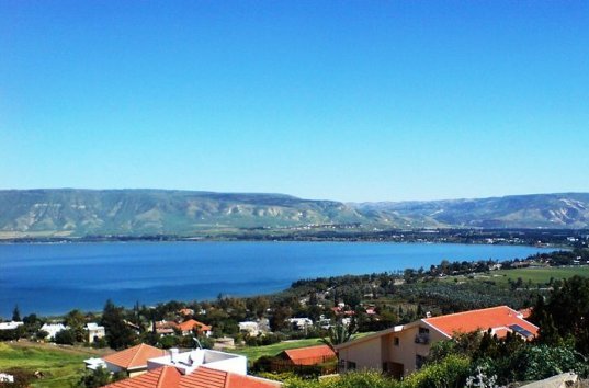
Lower Nahal Amud Stream to Upper Tiberias
Section 8
12 kilometers
Tiberias to Yardenit at the Jordan River
Section 9
28 kilometers
Jordan River to Mount Tabor in the Lower Galilee

The Israel Trail - Lower Galilee and Mount Carmel

Section 10
28 kilometers
Mount Tabor to Mashhad
Section 11
13 kilometers
Mashhad via Tsipori (and its ancient mosaics) to Yiftahel Junction
Section 12
21 kilometers
Yiftahel Junction to Kibbutz Yagur on Carmel mountain range
Section 13
16 kilometers
Kibbutz Yagur to Oren Campground near the prehistoric Etzba Cave
Section 14
20 kilometers
Oren Campground near the prehistoric Etzba Cave to Mount Horshan
The Israel Trail - Central Coastline

Section 15
16 kilometers
Mount Horshan to Jisr a-Zarqa
Section 16
15 kilometers
Jisr a-Zarqa to the Hadera Train Station
Section 17
22 kilometers
Hadera to Netanya's Green Beach
Section 18
22 kilometers
Netanya to Tel Aviv
Section 19
18 kilometers
Tel Aviv to HaYarkon Stream Source (Tel Afek / Antipatris)
The Israel Trail - Ascending to Jerusalem

Section 20
20 kilometers
Tel Afek / Antipatris to Mitzpe Modi'im in Ben Shemen Forest
Section 21
20 kilometers
Ben Shemen Forest to Latrun Station
Section 22
9 kilometers
Latrun Station to Sha'ar HaGai
Section 23
19 kilometers
Sh'ar HaGai to Kibbutz Zova
Section 24
23 kilometers
Kibbutz Zova to Horvat Hanut (Caesar Way)
The Israel Trail - the Judean Lowlands (HaShfela)

Section 25
21 kilometers
Horvat Hanut to Mitzpe Messuah
Section 26
11 kilometers
Mitzpe Messuah to Beit Govrin Caves
Section 27
20 kilometers
Beit Govrin to Tel Keshet
Section 28
21 kilometers
Tel Keshet to Dvir Junction
The Israel Trail - the Northern Negev Desert
Section 29
24 kilometers
Dvir Junction to just shy of Kramim
Section 30
21 kilometers
Kramim to Har Amasa
Section 31
15 kilometers
Har Amasa to Arad Park
Section 32
41 kilometers
Arad Park to Mezad Tamar
The Israel Trail - the Negev Desert

Section 33
30 kilometers
Mezad Tamar to HaMakhtesh HaGadol
Section 34
32 kilometers
HaMakhtesh HaGadol to Ma'aleh Zin
Section 35
12 kilometers
Ma'aleh Zin to Ein Shaviv
Section 36
40 kilometers
Ein Shaviv to Mitzpe Ramon
Section 37
14 kilometers
Mitzpe Ramon to Har Saharonim
Section 38
32 kilometers
Har Saharonim to Sapir Park in the Arabah Desert

The Israel Trail - the Arabah

Section 39
83 kilometers!
Sapir Park to Neot Smadar (Shizafon Junction)
Section 40
47 kilometers
Shizafon Junction to Timna Park
Section 41
13 kilometers
Timna Park to 2 kilometers north of Be'er Ora
Section 42
26 kilometers
Be'er Ora to Shehoret Canyon in the Mountains of Eilat
Section 43
16 kilometers
Shehoret Canyon to Ein Netafim and Mount Yoash
Section 44
14 kilometers
Mount Yoash to the border of Taba, Egypt!
You may also be interested in:

Please like us!

Recent Articles
-
Our House Guide Levi wins Tripadvisor Traveler's Choice 2020!
Aug 24, 20 05:23 PM
We are so proud of Levi - our house tour guide in Israel! He is a Tripadvisor Traveler's Choice Winner for 2020, and has been selected for the second year in a row! Tourists love touring with Levi a… -
Farewell to Sde Dov Airport in Tel Aviv
Aug 08, 20 07:28 AM
 Read the story of Tel Aviv's Sde Dov Airport, opened during the days of the British Mandate in 1938 and permanently closed in 2019.
 -
Tomb of Absalom on the Mount of Olives in Jerusalem
Jul 25, 20 12:42 PM
 Discover the fascinating history of the monumental Tomb of Absalom. It's the largest of the tombs in the Kidron Valley and the Mount of Olives in Jerusalem.


Find a Hotel in Israel
(This is an "affiliate link", which means that if you click and buy something, we earn a small commission at no extra cost to you).
Popular Pages


Facebook Comments
Enjoyed your visit? Have something to say? Why not leave a comment in the box below.